 Alerua
Severe weather
How to spot a tornado on radar
The hook echo, the rotation pair on velocity and the debris signature, on the El Reno storm of 2013 and a Dallas tornado in 2019.
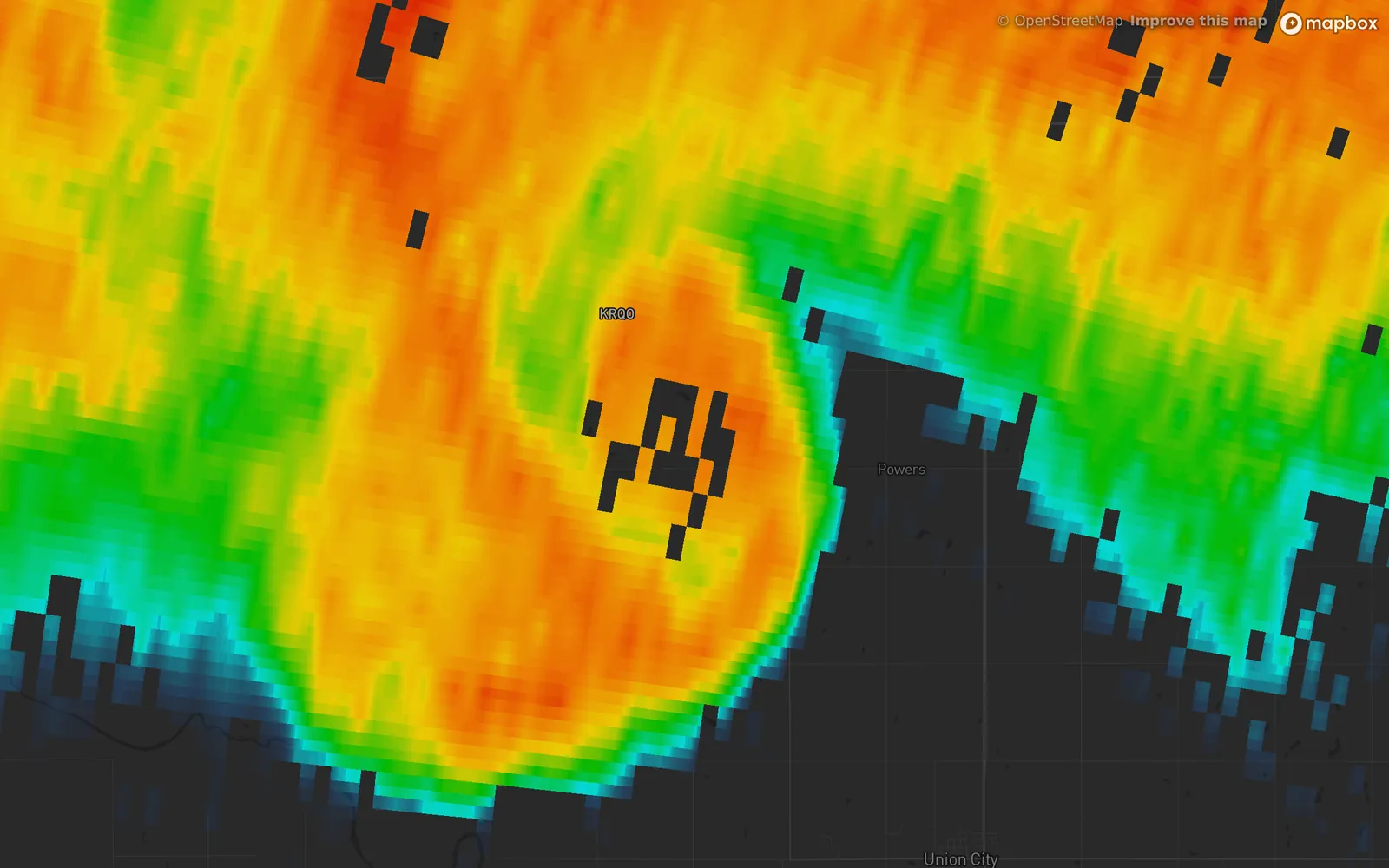
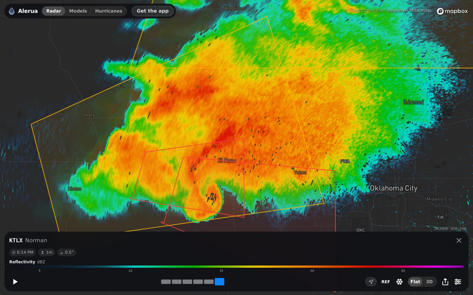
- KTLX Norman
- 6:14 PM CDT, May 31, 2013
- 0.5° tilt
- Reflectivity
- 1The hook
- 2Gaps where the echo was too jumbled to be rain
Radar can’t see a funnel. From 40 miles away the beam is most of a mile wide, wider than many tornadoes. It sees the storm that makes them and sometimes what the tornado picks up. Forecasters look for three signs in the same place: a hook on reflectivity, a tight pair of green and red on velocity, and a patch of low correlation coefficient where debris is in the air. One alone is a hint. All three together is as close as radar gets to confirmation.
The hook echo
The first sign is the hook echo: a curl of rain and hail wrapped around the southwest side of a supercell, a thunderstorm with a rotating updraft. The El Reno hook above was scanned eleven minutes after the National Weather Service says the tornado began.
Rotation on velocity
The second sign is on velocity, the Doppler view: green is rain moving toward the radar, red is rain moving away.
Rotation shows up as a pair. Where a patch of green sits right beside a patch of red, the air between them is turning. Looking out from the radar, green on the left and red on the right is counterclockwise rotation, the way most tornadoes in the Northern Hemisphere turn. The tighter and brighter the pair, the more worrying it is. When it lines up with the hook and a debris signature, forecasters treat it as a tornado on the ground even if no one has seen it.
On US radars, Alerua’s storm relative velocity view subtracts the storm’s own motion, which makes rotation easier to see.
The debris signature
The third sign is the gaps at the center of the hook, marker 2 in the first picture. Rain returns a clean, uniform echo. Debris does not: shingles, insulation, leaves and dirt tumble in every direction and send back a jumble. Alerua’s Filter ground clutter switch, on by default, hides any gate that jumbled, a correlation coefficient below 0.8. Switched off, the gates come back, and two dual-polarization views show what they are.
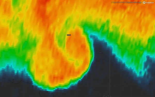
- Reflectivity, filter off
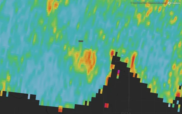
- Correlation coefficient
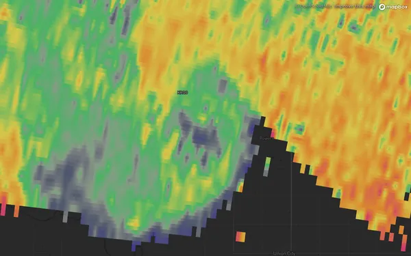
- Differential reflectivity
A debris ball
On the night of October 20, 2019, an EF3 tornado crossed north Dallas in view of the Dallas–Fort Worth radar (KFWS). With the filter off, the gaps at the end of its hook become a red spot, a debris ball: debris lofted high enough to read as a strong echo.
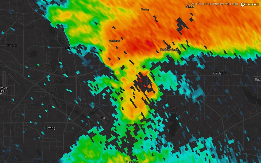
- KFWS Dallas/Fort Worth
- 9:13 PM CDT, Oct 20, 2019
- Filter on
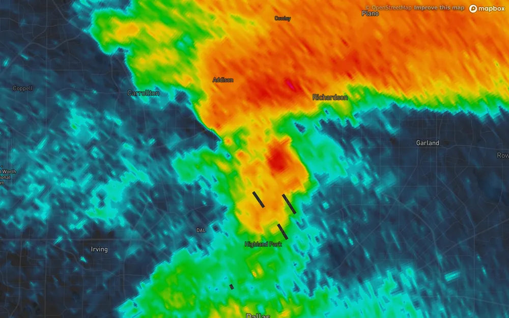
- Filter off
A warning beats the radar
None of this replaces a warning. The beam can miss a tornado that is small, shallow or far from the radar, and a National Weather Service warning is the signal to act on.
If you are inside a tornado warning, take shelter. Don’t wait to find a hook.
Keep reading
- Severe weatherHow to spot hail on radarWhy a red core can be hail or heavy rain, what the two dual-pol maps add, and what radar can’t tell you about size.
- Weather alertsWatch vs warning: what each one meansWhat a watch and a warning say for tornadoes, severe storms and floods, and how they look on a radar map.
- Doppler radarHow Doppler radar worksHow the radar measures wind, why it only sees motion toward or away, and where the reading breaks down.
Further reading
- NWS Norman: the El Reno tornado, May 31, 2013
- NOAA JetStream: radar images, velocity
- NEXRAD Level II data on the Registry of Open Data on AWS
Radar data from NOAA’s NEXRAD Level II archive. Warnings from the National Weather Service via the Iowa Environmental Mesonet. Base map © Mapbox © OpenStreetMap contributors.